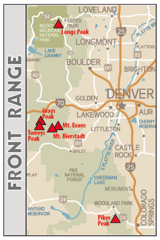
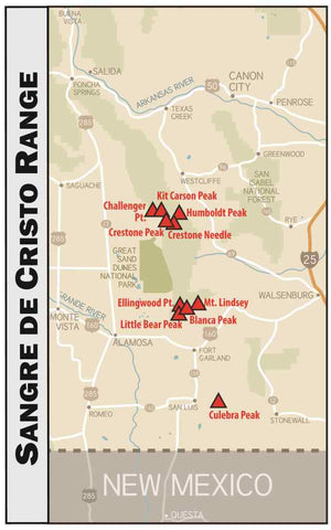
Colorado 14'ers Series
Get the detailed information you need to summit Colorado's 14er's.
All Colorado 14er climbing/hiking maps contain the following information for each route:
1) Delineation of the climbing route on a detailed base map (including roads, public land boundaries, contours (80' intervals), and hydrology (streams, lakes, etc.)
2) Difficulty of the climb rated by Class (Yosemite Decimal System)
2) Exposure Rating
3) Snow Steepness
4) Length of the Route
5) Elevation Gain & Loss
6) Starting Elevation
7) Elevation Profile
8) Waypoints (landmarks) and their mileages along the route
9) Detailed description for locating the trailhead
The maps in this series are 3-5/8" W X 4-1/4" H (when folded) and are 17" X 11" (when unfolded) and they are both waterproof and tear-resistant.


More 14er hiking/climbing maps coming soon!
FREE SHIPPING ON ALL ORDERS OVER $35!
To purchase any of these map products CLICK on the cover photos below.


