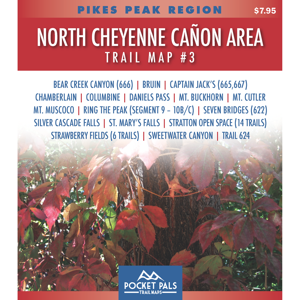
North Cheyenne Canon Area Trail Map - Pikes Peak Region, Map #3

$5.95
Choose Product Type - Digital or Paper
  • 5 stars: 24 (96%)
  • 4 stars: 0 (0%)
  • 3 stars: 1 (4%)
  • 2 stars: 0 (0%)
  • 1 star: 0 (0%)
C
Carol L.
Very good customer service

I thought I had ordered a paper copy of a map and I had actually ordered the digital version. I was confused and they were very helpful and quick resolving that issue for me. I like the small maps as they fit in a pocket and our water repellent. I also ordered the pouch so I can have the larger map of the area in the front and the smaller maps in the back. All seem good quality.

S
Susan C.
Great little maps

i love having a small but complete and easy to read map to put in a pack or even pocket. As someone who needs reading glasses, i can even read most of the trails on these, colors are great for this.

K
KYLE S.
Handy Have-along for Hiking This Area.

These trails close to town are typically pretty well marked anyway, but winter hiking is always a bit more difficult with snow covering what would be obvious trails in warmer months. Decent detail and convenient size. If I had any niggle at all, it would be that adjoining maps don't maintain the same scale as their neighbors so adds a degree of difficulty when your trip takes you across the boundary from one map to the next. But understandable given the scope of what they are trying to cover while maintaining a consistent pocket size. I must like them as I have accumulated 6 so far...

J
John V.
Detailed and Up to Date

Very detailed and they have all the latest trail updates. Rugged and should last years.

J
Jill P.
Great Planning Tool

This map makes planning a custom loop trail easy, incorporating numerous trails to make our own personalized loop.
In addition, we've never seen so much detailed trail data on a map before. Very awesome!

J
Jeff I.
Trail Running N. Cheyenne Canon

This digital map was extremely helpful. The resolution was much better than what you can find online, and as a visitor from out-of-town the GPS overlay was a lifesaver after making a couple of wrong turns.

T
Terry S.
Review of Map #3

It is just what I was looking for. Shows me where to start the trail and it shows its path. Thanks.

T
Taylor S.
Great Maps

There's nothing like having a paper map in case the electronics quit. I made a mistake on the order but they corrected it without any problem and I received the maps very quickly. A very satisfied repeat customer.

A
Adriane M.
Best maps for hiking and biking in the Pikes Peak Area

These are my go-to maps for hiking and biking in the Pikes Peak Area. They are easy to read and have excellent trail descriptions and landmarks. And of course, they fit in your pocket!

J
James V.H.
Great quality

A great map that is a very useful size.

J
James V.H.
Congratulations!

After searching for good, accurate maps of the Chamberlain Trail in North Cheyenne Cañon and Strawberry Hill, we found that you had the only correct map! Congratulations! Jim

E
Emil R.
North Cheyenne Canyon Trail Map #3

So, so happy with this one and another I recently purchased. I do both the downloadable and the waterproof paper. Fantastic! Convenient!

M
Marcus B.
Excellent trail maps!

Pocket Pals are my go to source for maps for exploring the trails surrounding Colorado Springs! Compact and easy to read, you need these if you want to explore new trails.

C
Charleyne H.
Snappy little maps

These are spectacular maps! I am in the midst of planning my hike up the renowned Pikes Peak (and little hikes in the area) and I doubt I'd want to do it without these magnificent gems!

Keep up the great work, team!

L
Lisa T.
Not able to print

The map is great but cant print the file. I have nothing to open the file on while hiking.

T
Tom B.
Perfect for Scouts

The perfect map for taking my cub scouts hiking.

J
John V.
Updated Map

Excellent handy waterproof tear resistant and best of all always up to date

N
Nicole R.
Compact and Detailed

I love these Pocket Pals. You take just the map you need for the region you're going to hike, and the details are spectacular. Thank you!

C
Carol P.
Trail Map #3

Great product. Seems detailed enough and durable.

s
shane S.
N Cheyenne

these are fantastic maps the perfect size easy to read durable

C
Christopher L.
Great

Great product. Very detailed. Folds perfect every time. I like that they are made of thick paper. I’m working on getting all the maps as I’m working my way through the ton of trails. I first heard about pocket pals from a local hiker who told me I needed a better map when I was very clearly lost. He told about a cool little local shop that sold them and I haven’t hit a trail without one since.

J
James A.
These maps are great

These maps have all the pertinent information for each hike. They fit in a shirt pocket. I washed one by mistake and it didn’t fall apart. Easy to read too. I purchased two just to try them out, then bought six more.

J
Joe A.
Trail Map 3 North Cheyenne Canon Area Review

It's an excellent map to keep on you when hiking in the North Cheyenne Canon area. It's compact and durable yet provides plenty of detail. I will be purchasing other maps for areas I will be hiking later this year.

C
Charles B.
Map #3

Each new version is an excellent update. We have all 14 of the local trail maps and have done about 2/3 of them. The #3 provides a great update of the 7 Bridges Trail and many of the other trails it covers are updates. Certainly beats the traditional topos update ever decade or so.

d
diana b.
Good Scale

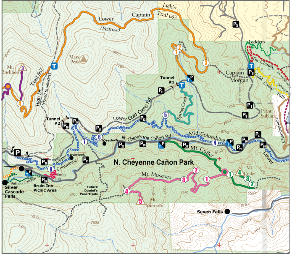
I like how this map ties together several systems - the Bear Creek system, the North Cheyenne System, Stratton Open Space, and connections to some others. It shows suggestions of some, but not all, social trails. I was a little surprised it is missing the trail to summit May's Peak. I like that it has the new Trail 667/Captain Jack's. I also like that it has the county line. I have the whole series of these maps and they are very handy to have on the trail - great size, great sturdy and waterproof paper.

  • 5 stars: 24 (96%)
  • 4 stars: 0 (0%)
  • 3 stars: 1 (4%)
  • 2 stars: 0 (0%)
  • 1 star: 0 (0%)
C
Carol L.
Very good customer service

I thought I had ordered a paper copy of a map and I had actually ordered the digital version. I was confused and they were very helpful and quick resolving that issue for me. I like the small maps as they fit in a pocket and our water repellent. I also ordered the pouch so I can have the larger map of the area in the front and the smaller maps in the back. All seem good quality.

S
Susan C.
Great little maps

i love having a small but complete and easy to read map to put in a pack or even pocket. As someone who needs reading glasses, i can even read most of the trails on these, colors are great for this.

K
KYLE S.
Handy Have-along for Hiking This Area.

These trails close to town are typically pretty well marked anyway, but winter hiking is always a bit more difficult with snow covering what would be obvious trails in warmer months. Decent detail and convenient size. If I had any niggle at all, it would be that adjoining maps don't maintain the same scale as their neighbors so adds a degree of difficulty when your trip takes you across the boundary from one map to the next. But understandable given the scope of what they are trying to cover while maintaining a consistent pocket size. I must like them as I have accumulated 6 so far...

J
John V.
Detailed and Up to Date

Very detailed and they have all the latest trail updates. Rugged and should last years.

J
Jill P.
Great Planning Tool

This map makes planning a custom loop trail easy, incorporating numerous trails to make our own personalized loop.
In addition, we've never seen so much detailed trail data on a map before. Very awesome!

J
Jeff I.
Trail Running N. Cheyenne Canon

This digital map was extremely helpful. The resolution was much better than what you can find online, and as a visitor from out-of-town the GPS overlay was a lifesaver after making a couple of wrong turns.

T
Terry S.
Review of Map #3

It is just what I was looking for. Shows me where to start the trail and it shows its path. Thanks.

T
Taylor S.
Great Maps

There's nothing like having a paper map in case the electronics quit. I made a mistake on the order but they corrected it without any problem and I received the maps very quickly. A very satisfied repeat customer.

A
Adriane M.
Best maps for hiking and biking in the Pikes Peak Area

These are my go-to maps for hiking and biking in the Pikes Peak Area. They are easy to read and have excellent trail descriptions and landmarks. And of course, they fit in your pocket!

J
James V.H.
Great quality

A great map that is a very useful size.

J
James V.H.
Congratulations!

After searching for good, accurate maps of the Chamberlain Trail in North Cheyenne Cañon and Strawberry Hill, we found that you had the only correct map! Congratulations! Jim

E
Emil R.
North Cheyenne Canyon Trail Map #3

So, so happy with this one and another I recently purchased. I do both the downloadable and the waterproof paper. Fantastic! Convenient!

M
Marcus B.
Excellent trail maps!

Pocket Pals are my go to source for maps for exploring the trails surrounding Colorado Springs! Compact and easy to read, you need these if you want to explore new trails.

C
Charleyne H.
Snappy little maps

These are spectacular maps! I am in the midst of planning my hike up the renowned Pikes Peak (and little hikes in the area) and I doubt I'd want to do it without these magnificent gems!

Keep up the great work, team!

L
Lisa T.
Not able to print

The map is great but cant print the file. I have nothing to open the file on while hiking.

T
Tom B.
Perfect for Scouts

The perfect map for taking my cub scouts hiking.

J
John V.
Updated Map

Excellent handy waterproof tear resistant and best of all always up to date

N
Nicole R.
Compact and Detailed

I love these Pocket Pals. You take just the map you need for the region you're going to hike, and the details are spectacular. Thank you!

C
Carol P.
Trail Map #3

Great product. Seems detailed enough and durable.

s
shane S.
N Cheyenne

these are fantastic maps the perfect size easy to read durable

C
Christopher L.
Great

Great product. Very detailed. Folds perfect every time. I like that they are made of thick paper. I’m working on getting all the maps as I’m working my way through the ton of trails. I first heard about pocket pals from a local hiker who told me I needed a better map when I was very clearly lost. He told about a cool little local shop that sold them and I haven’t hit a trail without one since.

J
James A.
These maps are great

These maps have all the pertinent information for each hike. They fit in a shirt pocket. I washed one by mistake and it didn’t fall apart. Easy to read too. I purchased two just to try them out, then bought six more.

J
Joe A.
Trail Map 3 North Cheyenne Canon Area Review

It's an excellent map to keep on you when hiking in the North Cheyenne Canon area. It's compact and durable yet provides plenty of detail. I will be purchasing other maps for areas I will be hiking later this year.

C
Charles B.
Map #3

Each new version is an excellent update. We have all 14 of the local trail maps and have done about 2/3 of them. The #3 provides a great update of the 7 Bridges Trail and many of the other trails it covers are updates. Certainly beats the traditional topos update ever decade or so.

d
diana b.
Good Scale

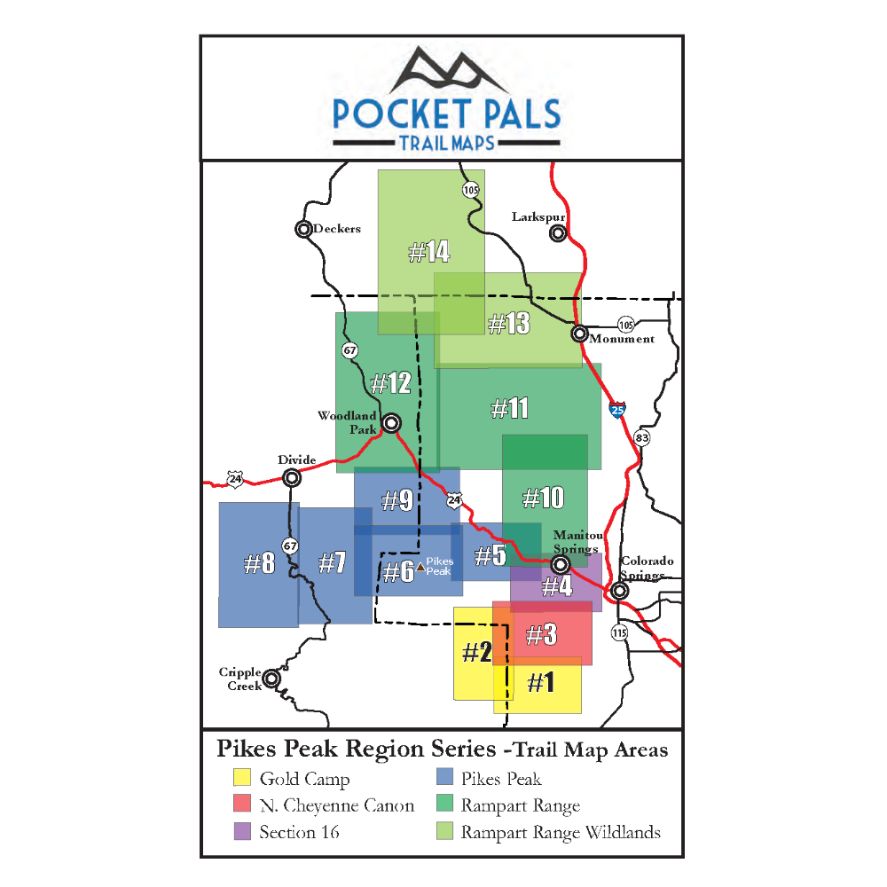
I like how this map ties together several systems - the Bear Creek system, the North Cheyenne System, Stratton Open Space, and connections to some others. It shows suggestions of some, but not all, social trails. I was a little surprised it is missing the trail to summit May's Peak. I like that it has the new Trail 667/Captain Jack's. I also like that it has the county line. I have the whole series of these maps and they are very handy to have on the trail - great size, great sturdy and waterproof paper.

×