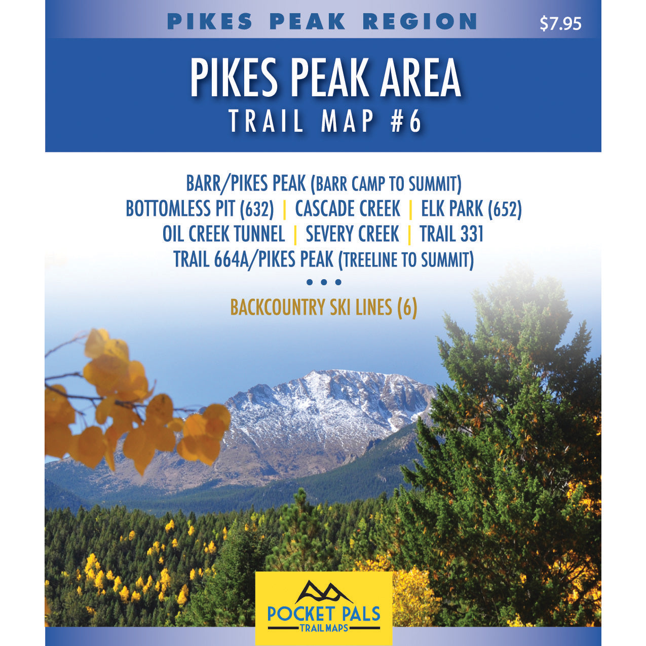


Trail Map #6 - Pikes Peak Region
$7.95
$6.36
20% OFF
The trails on this map are located around the summit of Pikes Peak and includes the Barr Trail from Barr Camp to the summit.
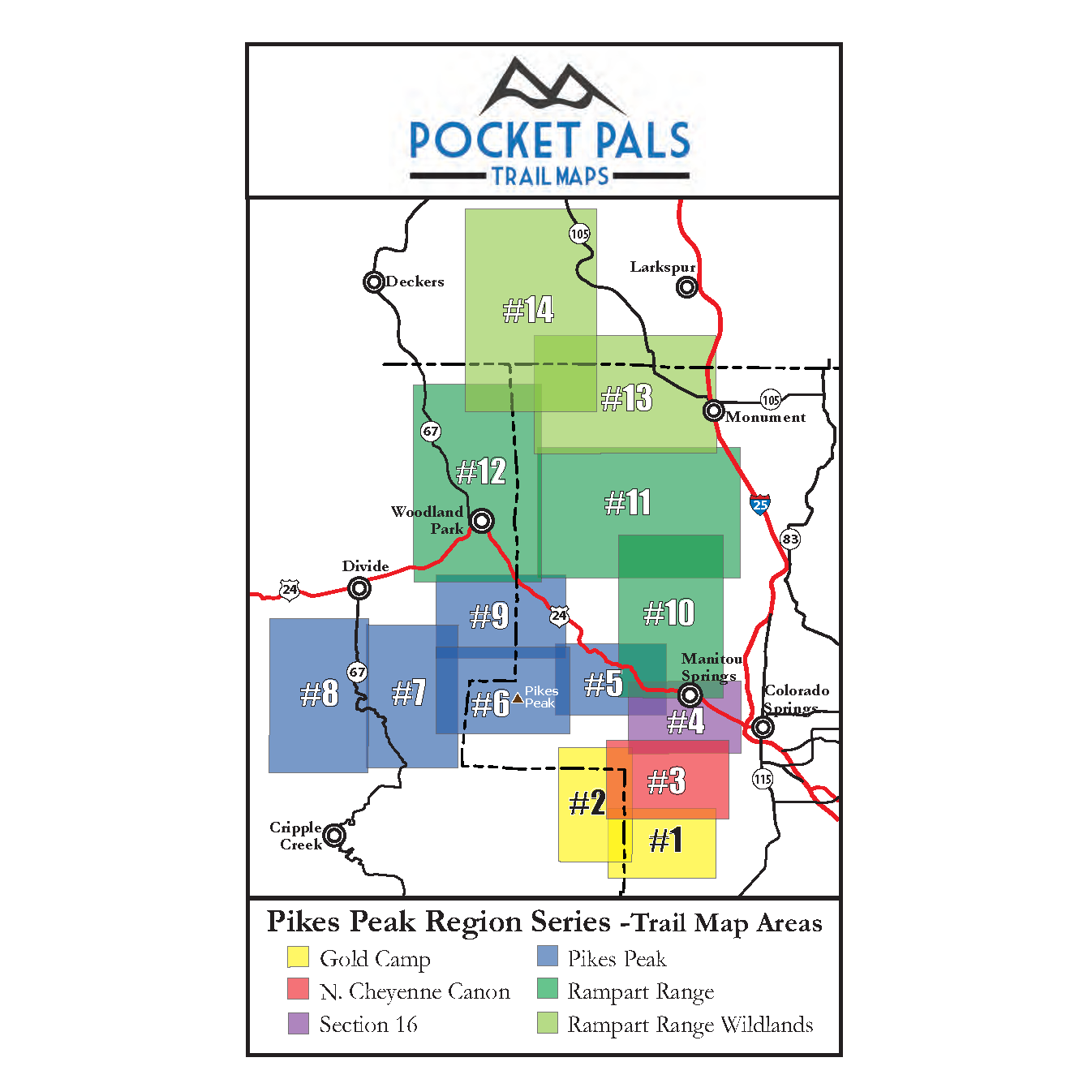
All of the trails on this map are in the Pike National Forest. To see an overview map of the Pikes Peak Region series, CLICK HERE.
The trails included on this trail map are listed below. For a detailed trail description of some of the trails, click on the underlined trail names below.- Bottomless Pit
- Cascade Creek
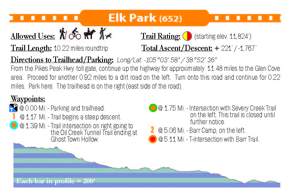
- Elk Park (Trail 652)
- Oil Creek Tunnel
- Pikes Peak via Barr Trail (Barr Camp to Summit)
- Pikes Peak via Crags-Trail 664A (Treeline to Summit)
- Severy Creek (currently closed)
- Trail 331
If your intent is to explore the many trails along the higher reaches of Pikes Peak, including the upper half of Barr Trail, Trail Map #6 is your best map option.
If your primary intent is to summit Pikes Peak, the Pikes Peak Fourteener map may be your best map option. Click here to review our Pikes Peak 14er map.
This map also includes six backcountry ski lines that are accessible from the Pikes Peak Highway (The Bowl aka Big Blue, The Chimney, the Cornice Bowl, Little Italy, Old Pikes Peak Ski Area, and the Y Couloir Middle Fork).
For more information about our digital (GeoPDF) map for Map #6, CLICK HERE.
Small, Pocket-Sized Maps for Big Colorado Adventures
Pocket Pals Trail Maps - Colorado Trail & Recreation Maps
Customer Reviews
Based on 1 review
Write a review